

India: 4th country to get a navigation satellite system
A proud moment for INDIA!! India gets its own navigation satellite system named IRNSS. India the 4th country to get a navigation satellite system. Indian Regional Navigation Satellite System is the full form of IRNSS. IRNSS is India’s own GPS-like system, much like the American GPS system. The primary service for the IRNSS is to provide location information to users in India and the region extending up to 1,500 km from the Indian boundary. The IRNSS can now replace the GPS in the Indian Ocean waters up to 1500 km from the boundary. The Indian Regional Navigation Satellite System is recognized by the International Maritime Organization(IMO) as a part of the World Wide Radio Navigation System(WWRNS).
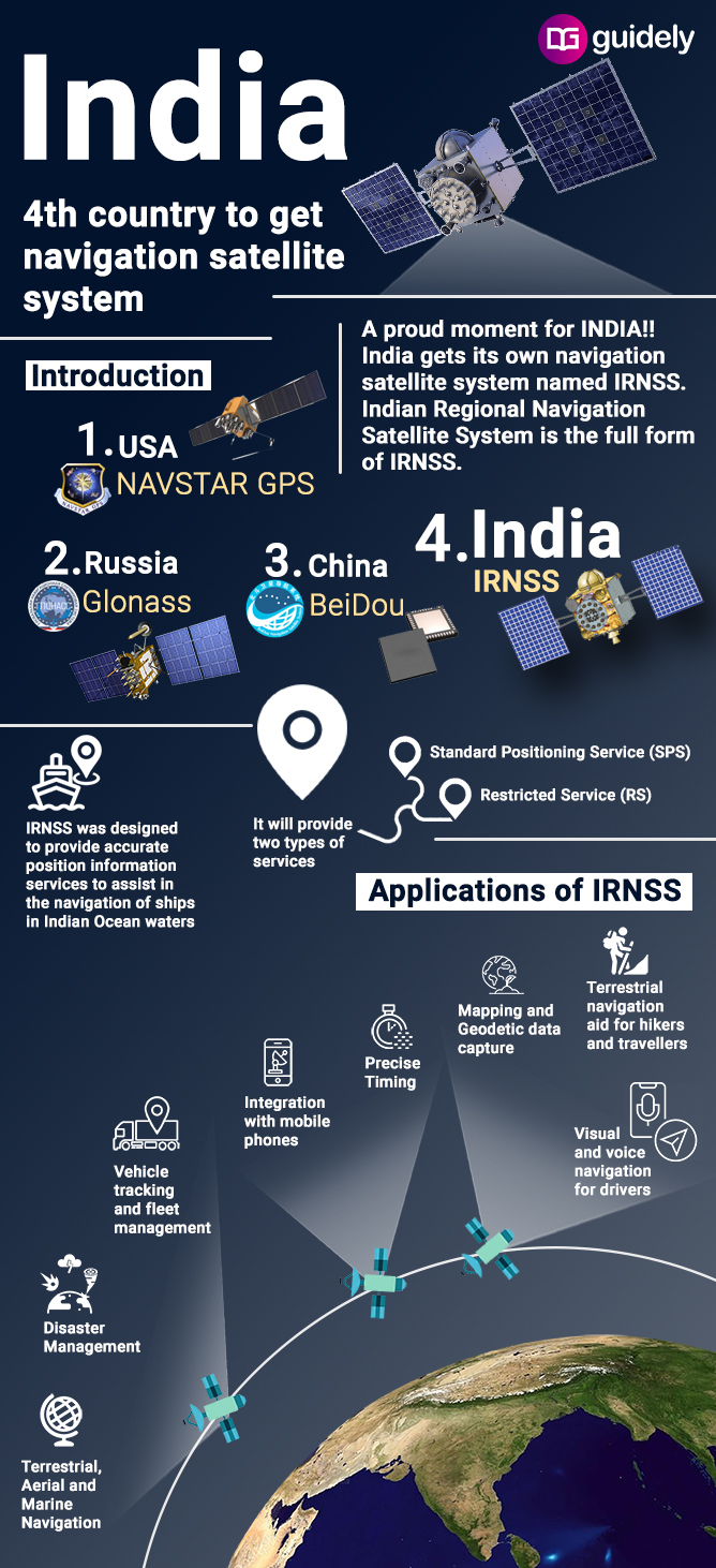
Introduction:
- India has become the 4th nation to get its navigation satellite system.
- The other three countries are the USA, Russia, and China.
- IRNSS was designed to provide accurate position information services to assist in the navigation of ships in Indian Ocean waters.
- It will provide two types of services i.e. Standard Positioning Service (SPS) and Restricted Service (RS)
Applications of IRNSS:
- Terrestrial, Aerial and Marine Navigation
- Disaster Management
- Vehicle tracking and fleet management
- Integration with mobile phones
- Precise Timing
- Mapping and Geodetic data capture
- Terrestrial navigation aid for hikers and travelers
- Visual and voice navigation for drivers


Subscribe
0 Comments