


Ministry of rural development and panchayat raj launched rural connectivity GIS data in public domain
What is the news:
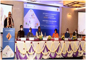
- Union Minister for Rural Development and Panchayati Raj Shri Giriraj Singh released Rural Connectivity GIS Data in Public Domain. ( Giriraj singh’s constituency – begusarai, Bihar)
- This includes GIS data for 800,000+ rural facilities as points, 1 Million+ habitations and 25,00,000+ km of rural roads which have been collected and digitized using the GIS platform developed for the PMGSY scheme.
- The data is released under Government of India’s Open Data License and is available free of cost for public consumption.
- Union Minister of State for Rural Development Shri Faggan Singh Kulaste and Sadhvi Niranjan Jyoti, were also present on the occasion.
- NRIDA, the nodal implementation agency of the PMGSY scheme signed MoU with 3 renowned GIS Firms ESRI India, MapmyIndia, DataMeet & collaborated with Gati Shakti for releasing the Rural Connectivity GIS Data in Public Domain.
- Ministry will be shortly launching a hackathon with the help of the DataMeet organization where the use of data released today can be used for the data visualization, policy research and other products with the overall objective of improving rural economy and ease of living.
- Pradhan Mantri Gram Sadak Yojana (PMGSY) was launched in the year 2000, with an objective to provide all-weather road connectivity to eligible unconnected habitations throughout the nation.
- The Pradhan Mantri Gram Sadak Yojana(PMGSY) is a nationwide plan in India to provide good all-weather road connectivity to unconnected villages.
- Later on, upgradation and consolidation of through routes and major rural links were also included as its objective to give a fillip to the rural economy.
- Since inception, 7.83 lakh Km roads have been sanctioned and 6.90 lakh Km have been constructed with an expenditure of Rs. 2.69 lakh crores.
- Gati Shakti is a national master plan and digital platform to plan and execute infrastructure projects in India to reduce logistics costs and enhance infrastructure. NRIDA is collaborating with Gati Shakti with an objective to exchange the data for better planning and implementation of both schemes.
About the Rural Connectivity GIS Data:
- GIS data will help in bridging the gap between urban and rural India and transform India into Atmanirbhar Bharat.
- The drones can be utilized for the delivery of essential commodities such as vaccines once all the addresses are digitized on the portal.
- under new technology, more than 1,00,000 km of roads have been sanctioned till date and under PMGSY-III, 50% of the roads have been sanctioned under new/green technology. For sanctioning, execution, maintenance and complaint redressal of these roads, NRIDA has made use of IT assets such as OMMAS, GEOSADAK, GePNIC, eMARG and MeriSadak. DG NRIDA emphasized that the MoU signed with the three partners on GIS data can be used in the business application for the benefit of the nation as a whole.
What is GIS:
- A geographic information system (GIS) is a type of database containing geographic data (that is, descriptions of phenomena for which location is relevant), combined with software tools for managing, analyzing, and visualizing those data.
- In general, GIS allows users to search for information about specific geographical areas, analyse spatial information, edit the data and create maps, charts and reports that show users the results in visual forms.
- GIS helps users to find answers to their questions and solve the problems by presenting data in simple visual ways.
- In a broader sense, one may consider such a system to also include human users and support staff, procedures and workflows, body of knowledge of relevant concepts and methods, and institutional organizations.
- A working GIS integrates five key components: hardware, software, data, people, and methods.
What are the advantages of GIS?
The advantages of using a geographic information system include:
- Improved decision making – decisions are made easier because specific and detailed information is presented about one or more locations.
- Reduce costs and increase efficiency – especially regarding maintenance schedules, fleet movements or scheduling timetables.
- Improved communication between any involved organisations or departments as the visual format is easily understood by all.
- Easy recordkeeping – geographical changes are easily recorded by GIS for those responsible of recording the changes.
- Managing geographically – knowing what is and will be occurring in a geographic space in order to plan a course of action.
Drawbacks of GIS :
- GIS technology might be considered as expensive software.
- It as well requires enormous data inputs amount that are needed to be practical for some other tasks and so the more data that is to put in.
- Since the earth is round and so there would be geographic error that will increase as you get in a larger scale.
- GIS layers might lead to some costly mistakes once the property agents are to interpret the GIS map or the design of the engineer around the utility lines of the GIS.
- There might be failures in initiating or initiating additional effort in order to fully implement the GIS but there might be large benefits to anticipate as well.

[…] is an unedited and auto-generated supporting article of the syndicated news feed are actualy credit for owners of origin […]